Rio Grande National Forest
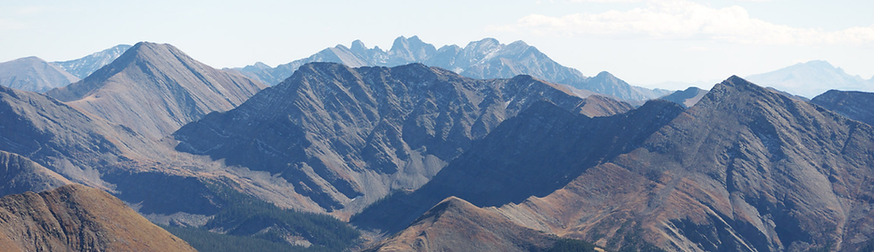
The layers of the Sangre de Cristo Mountains. Credit: Jesse Varner/Flickr
Overview
The Rio Grande National Forest, located in south-central Colorado, encompasses the Valley with over 1.8 million acres of the wildest terrain in the Southern Rockies. It is home to the headwaters of the Rio Grande — the lifeblood of the San Luis Valley.
Details
The Rio Grande National Forest boasts diverse ecosystems that begin as extensive grasslands, transition into pinyon and juniper woodlands, and then climb into alpine tundra. Critical wetlands are scattered throughout the region. These intact ecosystems provide habitat for wildlife, including the endangered Canada lynx and other sensitive species. The Rio Grande flows from southern Colorado into New Mexico and Texas before entering the Gulf of Mexico.
This national forest includes two distinct ranges: the San Juan Mountains and Sangre de Cristo Mountains. Shaped by intense volcanic activity, the San Juan Mountains are distinctive from the rest of the Rockies. This western section of the forest features ancient calderas and various peaks over 14,000 feet in elevation. To the east of the San Luis Valley, the Sangre de Cristo range protrudes as a narrow spine over the Rio Grande basin.
Wilderness Areas
Nearly 50% of the Rio Grande National Forest is designated as Wilderness Areas, contributing to its intact ecosystems. The national forest contains four wilderness areas: the La Garita, Sangre de Cristo, South San Juan, and Weminuche. This vast network of wilderness is a cornerstone of the national forest. These areas preserve biodiversity, provide ecological services, and protect access to solitude.
La Garita Wilderness
The La Garita Wilderness is among the original wilderness areas designated under the Wilderness Act of 1964. It features the volcanic Wheeler Geologic Area — one of Colorado’s most distinctive geological formations. The summit of San Luis Peak provides sweeping views of the Rio Grande basin. La Garita means "lookout" in Spanish. This area serves as an important migration route for large herds of elk and mule deer that winter in the San Luis Valley.
Sangre de Cristo Wilderness
The Sangre de Cristo Wilderness borders the Great Sand Dunes Park and Preserve. Likely due to the alpenglow that often illuminates the Sangre de Cristos, the mountains are named after the "Blood of Christ" in Spanish. Unlike the volcanic formation of the San Juan Mountains, this range was formed by the sudden uplift of massive rocks, shaping its distinctive, vertical peaks. It is home to Mount Blanca, known to the Navajo people as the Sacred Mountain of the East, which marks the traditional edge of their homeland.
South San Juan Wilderness
Characterized by volcanic activity and glacier erosion, The Continental Divide runs through the heart of this remote wilderness area for 42 miles.
Weminuche Wilderness
The Weminuche Wilderness is Colorado’s largest wilderness area. This rugged landscape traverses nearly 500,000 acres of fragile alpine ecosystems, with an average elevation of 10,000 feet. It spans the Continental Divide, diverting its waters to both the Pacific and Atlantic Oceans. The wilderness designation protects the source of the Rio Grande.
The landscape is divided into three Ranger Districts: Saguache, Divide, and Conejos Peak. Each steward manages their own section of the national forest based on community values.
Completed in 2020, the Rio Grande National Forest finalized their recent Land Management Plan. In accordance with environmental regulations, each national forest develops a comprehensive roadmap to balance natural resources for current and future conditions.
United States Forest Service (USFS)
U.S. Department of Agriculture