%20Kaitlyn%20Fletcher_SLVEC.jpeg)
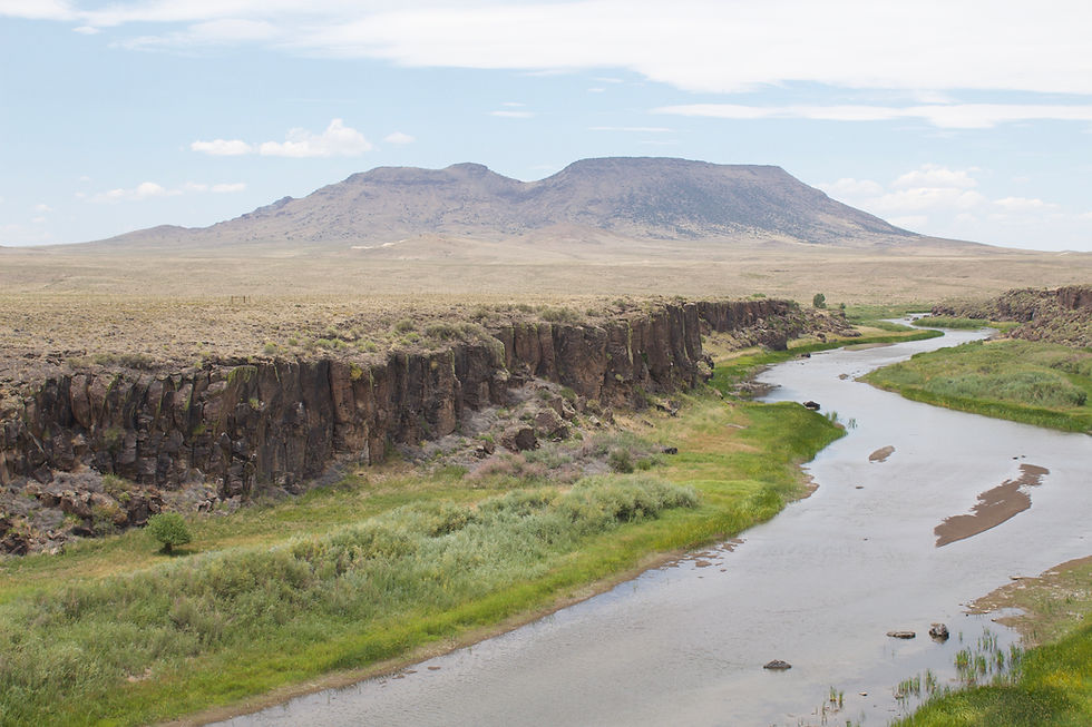
Flat Top is the highest point in the San Luis Hills. Credit: Kaitlyn Fletcher/SLVEC
Overview
The San Luis Valley Ecosystem Council (SLVEC) aims to inform policies that permanently conserve the Rio Grande watershed from the southern tip of the Alamosa National Wildlife Refuge to the New Mexico state line.
Initiated
March 1, 2020
Rio Grande Corridor Conservation
Details
Covered with rich ecological, historical, and cultural sites, the Rio Grande region showcases the overlap of cultures and their distinct relationships with the San Luis Valley's landscape over 13 millennia of human occupation.
SLVEC collected a baseline inventory of documents that analyzed the ecological, historical, and cultural significance of this site, which included 23 detailed maps and reports. Examples are wildlife migration stopovers, BLM grazing allotments, aquatic habitats, and more. In partnership with the Conservation Lands Foundation, SLVEC organized and shared this scientific research with local communities to highlight the significance of this special area.
Freshwater Ecosystems
Cultural Resources
Historical Sites
Wildlife Corridors
Traditional Uses
Plant Communities
Recreation Opportunities
Scenic Views

Rio Grande Project Area
A map of the potential Rio Grande National Conservation Area that could protect more than 66,000 acres of public lands, adjacent to, but not including, the Rio Grande Natural Area.
Designated by Congress in 2006, the Rio Grande Natural Area spans a ¼ mile on either side, meandering through private and public lands, for 33 miles from the Alamosa National Wildlife Refuge to the New Mexico state line.
Project Categories:
Conservation Areas, Heritage Areas, Rio Grande